
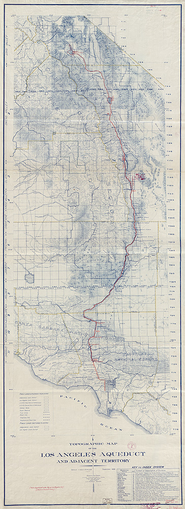
The original aqueduct constructed in 1913 begins at the Owens River intake located centrally in Owens Valley and continues 233 miles across mountains and the western Mojave Desert to its terminus at “The Cascades” located on the east side of the Golden State Freeway (near the I-5 and 405 merges in Sylmar). The second aqueduct starts at the Haiwee Reservoir just south of Owens Lake, roughly paralleling the original one until it ends at the Cascades. It is important to note that unlike the first aqueduct, which operates and produces electricity through its gravity flow design, the second aqueduct requires supplemental energy to pump water for export.
The combined infrastructure of the system is made up of sixty-one miles of lined and unlined channels, 161 miles of concrete conduit, forty-three miles of lined tunnels, and eighty-one miles of steel and concrete pipe. Eight storage reservoirs plus ninety-nine tanks and smaller reservoirs are located within city limits. Both aqueducts took five years to construct.[2]
The primary source of water for the aqueduct system is seasonal runoff containing snowmelt from the eastern slopes of the Sierra Nevada that drains into the larger Owens Valley watershed providing surface and sub-surface water for export. In addition, LADWP collects and exports water from the Mono Basin and its related watersheds through its second aqueduct. In order to access this water for export, the City of Los Angeles pursued an aggressive policy to acquire water rights and land within the Owens Valley in the earlier part of the twentieth century. Today, the city is the largest private owner of the seventy-five-mile-long Owens Valley with its 314,000 acres predominantly located within the valley’s floor. Most of this land, about 260,000 acres, is leased for ranching purposes with a small percentage leased for commercial or recreational use that involves strict management requirements to ensure the productivity and overall health of the watershed. Nearly 95 percent of lands within Inyo County are either owned by the City of Los Angeles, the state of California, or the federal government.[3]
Historically, the Los Angeles Aqueduct system provided nearly 75 percent of the city’s water supply up through the 1980s. However, due to restrictions and reallocation of water for environmental concerns, this amount has been reduced dramatically.[4] According to 2012 LADWP figures; 36 percent of Los Angeles’ water comes from the Los Angeles Aqueduct system; 52 percent from the Metropolitan Water District’s (MWD) Colorado River Aqueduct supply; 11 percent from local groundwater sources; and one percent is from recycled sources.[5] About 72 percent of this water is for residential use; 25 percent is for commercial and government use, and 3 percent is for industrial use.[6] Some areas, such as San Pedro, are served water from the MWD exclusively, others, such as Eagle Rock and east Los Angeles, are served a mix of MWD and Los Angeles Aqueduct water. The remaining areas are predominately served as a mix of water from the State Water Project combined with water from the Los Angeles Aqueduct.[7] Most agree that the highest quality and best-tasting water comes from the Eastern Sierra supply.
The Los Angeles Aqueduct may no longer be the exclusive municipal water supply for the city—but it continues to be the symbolic source of its drinking water.
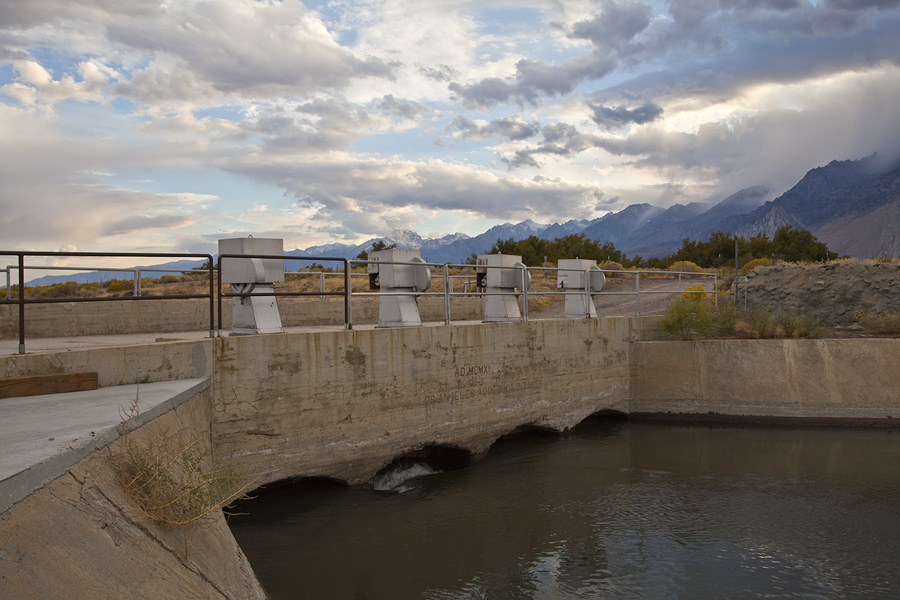
POI: Los Angeles Aqueduct Intake
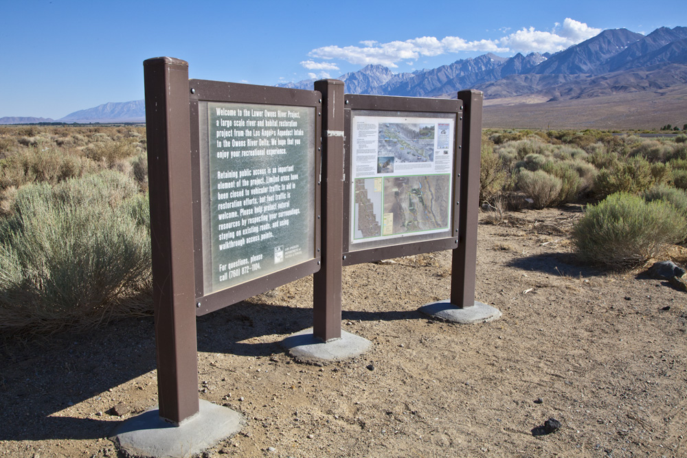
Traveling on U.S. Route 395, exit east onto Goodale Road north of Big Pine. Just past the Lower Owens River Project (LORP) display and Los Angeles Aqueduct historical marker you will encounter a closed ranch gate. Enter through the gate (be sure to close it behind you) and drive approximately 1.4 miles east on Goodale (dirt road) to the intake.
Latitude: 36.9741011º
Longitude: -118.2113457º
POI: The Cascades (Los Angeles Aqueduct terminus)
A view of the Cascades may be seen east of Interstate 5 in Sylmar at the 405/I-5 merge. An off-highway viewing area can be reached 0.1 miles north of the intersection of Foothill Blvd and Balboa Blvd, four miles northwest of San Fernando.
Latitude: 34.324680º
Longitude: –118.497643º
Track Credits
View of the original Los Angeles Aqueduct pipelines in the far upper right and the second aqueduct at left at the Cascades near Sylmar, CA. Photo: Library of Congress.
FOOTNOTES (click to open/close)
[1]“Los Angeles Aqueduct Facts & History,” LADWP, accessed October 5, 2012, https://www.ladwp.com/ladwp/faces/ladwp/aboutus/a-power/a-p-factandfigures.
[2] “Los Angeles Aqueduct: Facts & History.”
[3] Greg James, “Changing Perspectives on Groundwater Management: The Owens Valley (2002),” Inyo County Water Department, accessed September 8, 2012, http://www.inyowater.org/About_ICWD/chg_pers.htm.
[4] Fred Barker, LADWP Waterworks Engineer, Manager of Transmission Operations, interview with Kim Stringfellow in Los Angeles, March 2012.
[5] Based on a five-year average dated March 16, 2012. “Los Angeles Aqueduct Facts & History,” LADWP, accessed on September 24, 2012.
[6] Aquafornia, accessed September 24, 2012, http://www.aquafornia.com/where-does-californias-water-come-from/the-los-angeles-aqueduct.
[7] Fred Barker interview.